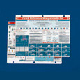
Quick Reference Cards offer a wealth of information in a handy, colorful, and easy-to-understand format. Made of three-hole punched weatherproof high-strength plastic.
Boating Guide covers small-craft seamanship including pre-departure checklists, troubleshooting, and safety information.
Celestial Navigation guides you through the steps needed to find your location using the sun and stars.
Coastwise Piloting covers dead reckoning, compass readings, distance off, current and leeway corrections, and much more.
International Nav Rules covers differences between buoyage systems and regions, plus right of way, signal flags, and more.
Marine Electronics offers key information on GPS, LORANC, RDF, radar, depth sounders, and radio communications.
Navigation Rules covers the U.S. buoyage system, inland and international rules, right of way, lights, and sound signals.
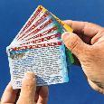
Pocket Quick Reference Cards measure just 3 x 4" (7.6 x 10.2 cm) each and are joined with a stainless steel ring. These six cards include essential information on: Predeparture Check, Fueling Procedures, U.S. Buoyage, Rules of the Road, Navigation Lights, Emergencies, Radio Use, and much more.
Weather Forecasting includes information on how to predict the weather plus critical info on boating in hazardous conditions.
Boating Guide
Covers all the basic procedures and equipment. Includes predeparture checklist, recommended equipment & spare parts, fueling procedures, engine troubleshooting, radio use, trailering, launching, anchoring, knot tying, water-skiing hand signals. Gives rules of the U.S. Buoyage System and right-of-way. Helps in emergencies by covering distress signals, fire procedures, towing, weather warnings, and first aid (hypothermia &CPR)
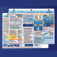
Celestial Navigation
A simplified, yet complete Celestial Navigation system. Includes everything you need: sextant use and corrections, starfinder for 18 stars, data entry form, and step-by-step sight reduction and plotting procedures. May be scored and separated; large portion fits in the sextant case for quick reference, and small part acts as a waterproof data reduction card.
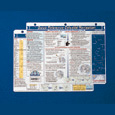
Coastwise Piloting
All the piloting information you need at your fingertips: dead reckoning basics, true and magnetic compass relationships, position finding, estimating distance off, current and leeway corrections. Helpful hints on chart reading, preparations, and checklists, fog navigation, and depth soundings without a fathometer. Includes time, distance & speed calculator, relative bearing gauge for distance off calculations, and common chart symbols.
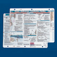
International Nav Rules
A comprehensive guide incorporating the International Maritime Buoyage System and COLREGS. Clarifies differences between Cardinal and Lateral buoyage systems and buoyage regions, key to reducing confusion and danger when entering unfamiliar waters or busy harbors. Complete details on right-of-way, sound signals, entering and clearing a foreign port, lights and day shapes, collision prevention procedures and signal flags.

Marine Electronics
Comprehensive information. NAVIGATION: GPS, LORANC, RDF, radar, depth sounder. COMMUNICATIONS: VHF, SSB, CB, EPIRB, HAM. Includes procedures, rules, tips and problem solving. "Marine electronics are vital to the safety and enjoyment of your boat. This card removes any confusion about the proper use of the electronics. Concisely written and easy to understand." — Clyde Kirlin, marine electronics consultant.
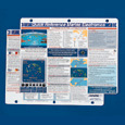
Navigation Rules
A proven navigation tools used by the US Coast Guard, US Coast Guard Auxiliary and US Power Squadron. Navigation Rules feature US. Buoyage System, inland and international rules, right-of-way, lights, sound signals and bridge signals. All presented in graphic summary and easy to read. Complete, precise, and accurate.
Pocket Quick Reference Cards
Designed in cooperation with the U.S. Coast Guard Auxiliary and the U.S. Power Squadrons, Pocket-sized Quick Reference Cards simplify boating procedures and safety. Like Davis' popular line of standard Quick Reference Cards, the new cards are easy to read, printed on plastic in full color, and built to withstand the elements. The set of six 3 x 4" cards (7.6 x 10.2 cm) are joined with a stainless steel ring and include essential information on: Predeparture Check, Fueling Procedures, U.S. Buoyage, Rules of the Road, Navigation Lights, Emergencies, Radio Use, In Case of Fire, Navigation Rules, Sound Signals, and Hypothermia/CPR.
Weather Forecasting Quick Reference Card
Shows the use of wind direction, barometric pressure, and cloud type in predicting the weather, plus a full list of radio weather stations for official broadcasts, key information on storm warnings, hurricane avoidance, navigating in fog and other hazardous conditions, and more. Weatherproof high-strength plastic, full color both sides. Punched for binder or bulkhead mounting. Dimensions: 8.5" x 11" (216 x 279 mm).

Producing Area:USA